Plane Table Surveying - Principle, Method, Definition
Definition
The plane table surveying is defined as the graphical method that is used for plotting plan in the field and for the various types of measurement.
Or
The graphical construction of angles, straight line and triangle for plotting the details of ground points.
This survey is mainly used for mapping of area which are not big, Either it is small or medium scale. We do not use it in big area because it requires great accuracy.
Basic Principle
Meaning of Parallelism : It is a rays drawn from ground station to the object in our drawing sheet, parallel to line from ground station to object on the ground.
In other words:
Parallel means two lines are parallel to each other which does not touch even if we extend it to infinity. It means if lines in the ground is same as line in plane table but in small scale.
In other words:
Parallel means two lines are parallel to each other which does not touch even if we extend it to infinity. It means if lines in the ground is same as line in plane table but in small scale.
For example, line AB and line CD are parallel in below Image:
It means that if we extends line AB in both directions to infinity in Plane Geometry, and also extends line CD in both Directions to Infinity, then they do not intersect with each others.
Note that this is for Plane Geometry, there are other types of Geometry, where it can intersect. But because we can assume our real world to approximate plane geometry for purpose, we can use this principle.
Required Instruments
The list of instruments used in the plane table surveying is given below.
- U-fork
- Alidade
- Plane table
- Spirit level
- Through compass
Plane table has three types based on leveling and how can we control it.
- Coast survey table
- Traverse table
- Johnson plane table
There are two types of alidade, a device which is used for sighting objects and drawing rays from it.
- Telescopic alidade
- Plain alidade
Procedure
Plane table set up is a basic skill civil engineer should have.
- First fix the table on tripod stand.
- Leveling the table by moving it's leg and for accurate level see the position of spirit level.
- Plane table should be at the center, so do centering of instrument.
- After centering, make one north line at the top corner about right hand side and when compass is show exact zero than mark it as north.
- Do orientation at every station.
 |
| Click to Zoom |
Methods
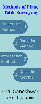
- Traversing method
- Radiation method
- Intersection method
- Resection method
In this four methods, the resection method is most complicated method and it is further have some special method that is included two point problem and three point problem.
Traversing and Resection method is generally use for locating the station of Plane table and other two method is used for locating details needed to do surveying.
Now, let we see the methods in more details important for the work.
Radiation Method
In this method, we are locating object from the only one station.
This is mainly use where the distance that we want is smaller and it is measurable with our measurement instrument. We have to start from drawing the rays from station to object that is within some better scale.
Steps
First let's assume one station on the surface of the ground and this point is assume in such a way that other points are visible from that point.
After that do centering, levelling and other set up for the plane table.
Then, draw the point in sheet where the plane table is plotted. Mark the north line in the drawing sheet in the direction of North and it is magnetic north that we draw.
From the instrument, take the alidade and this is near to point that draw on sheet represent the fixed point in ground.
Put the ranging rods on the various points that we have to measure and bisected it. After it, Draw the rays. Distance from the plotted point to various point is measured and with some best scale draw this point on the drawing sheet.





Comments
Post a Comment